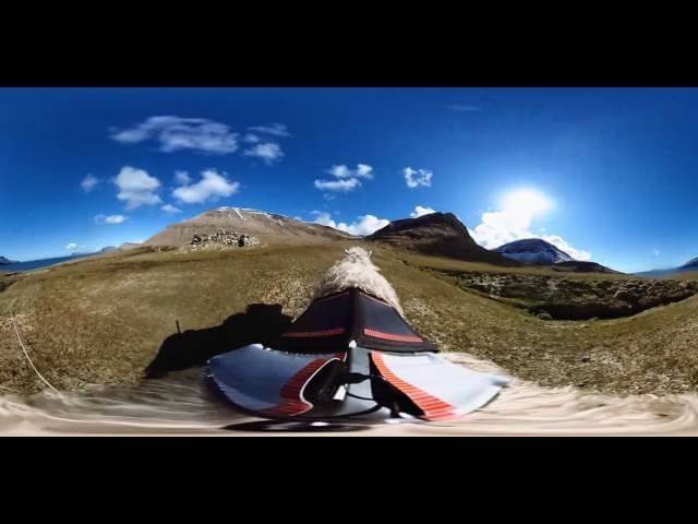
Instead of Google Street View, this island country has Sheep View

On the Faroe Islands, it’s a sheep’s, sheep’s, sheep’s world. An archipelago between the Norwegian Sea and the North Atlantic Ocean, the Faroe Islands comprise 18 small islands that are so remote, Google Maps has not yet provided a “Street View” option for the country. But Durita Dahl Andreassen, who works with the Faroe Islands tourism board, had her own idea for capturing the island’s terrain and roads in detail: sheep view. The tourism board mounted 360-degree cameras on a sheep and sent it forth into the wild, giving birth to “Sheep View 360.”
“Here in the Faroe Islands we have to do things our way,” Andreassen said in an interview with The Guardian. “Knowing that we are so small and Google is so big, we felt this was the thing to do.” The subtext here, of course, is: Wake up, sheeple! Google is getting too big! The end of times is near! It’s time to turn away from big tech and embrace sheep tech.
The country is home to some 80,000 sheep, so doing things the Faroe Islands way definitely means doing things the sheep way. Andreassen worked with a local shepherd and a fellow islander who built a special harness to outfit five of the island’s many sheep with the cameras. As the sheep go about their sheep business around the island, the pictures are sent back to Andreassen with GPS coordinates that she then uploads to Google Maps’ Street View. So far, Sheep View 360 has captured panoramic images of five locations on the Faroe Islands. The sheep have been taking 360 video footage as well, so if visiting the Faroe Islands but experiencing the trip as if you were a sheep has been a lifelong dream of yours, well, Sheep View 360’s got you. The life of a sheep doesn’t appear to be all that exciting, but the view is still beautiful.